 Paikkatietohakemisto
16 m
Type of resources
Available actions
Topics
Keywords
Contact for the resource
Provided by
Years
Formats
Representation types
Update frequencies
Scale
Resolution
-
Harvester Seasons is a service designed to help with estimating evolving trafficability conditions in forested terrain based on weather and model forecast information. The full service is currently provided for the geographical area of Finland.
-
Tietotuote sisältää Manner‐Suomen alueelta korjuukelpoisuuskarttoja rasterimuodossa. Tuote kuvaa maaperän staattista korjuukelpoisuutta (kantavuutta), joka on laskettu kaukokartoitusaineiston (laserkeilauksen) ja maastotietokannan aineistojen perusteella. Korjuukelpoisuus on luokiteltu kuuteen luokkaan.
-
The Finnish Forest Research Institute (Metla) developed a method called multi-source national forest inventory (MS-NFI). The first operative results were calculated in 1990. Small area forest resource estimates, in here municipality level estimates, and estimates of variables in map form are calculated using field data from the Finnish national forest inventory, satellite images and other digital georeferenced data, such as topographic database of the National Land Survey of Finland. Nine sets of estimates have been produced for the most part of the country until now and eight sets for Lapland. The number of the map form themes in the most recent version, from year 2019, is 45. In addition to the volumes by tree species and timber assortments, the biomass by tree species groups and tree compartments have been estimated. The first country level estimates correspond to years 1990-1994. The most recent versions are from years 2005, 2007, 2009, 2011, 2013, 2015, 2017 and 2019. The maps from 2019 is the fifth set of products freely available. It is also the fourth set produced by the Natural Resources Institute Finland. A new set of the products will be produced annually or biannually in the future. The maps are in a raster format with a pixel size of 16m x 16m (from 2013) and in the ETRS-TM35FIN coordinate system. The products cover the combined land categories forest land, poorly productive forest land and unproductive land. The other land categories as well as water bodies have been delineated out using the elements of the topographic database of the Land Survey of Finland.
-
The Finnish Forest Research Institute (Metla) developed a method called multi-source national forest inventory (MS-NFI). The first operative results were calculated in 1990. Small area forest resource estimates, in here municipality level estimates, and estimates of variables in map form are calculated using field data from the Finnish national forest inventory, satellite images and other digital georeferenced data, such as topographic database of the National Land Survey of Finland. Nine sets of estimates have been produced for the most part of the country until now and eight sets for Lapland. The number of the map form themes in the most recent version, from year 2017, is 45. In addition to the volumes by tree species and timber assortments, the biomass by tree species groups and tree compartments have been estimated. The first country level estimates correspond to years 1990-1994. The most recent versions are from years 2005, 2007, 2009, 2011, 2013, 2015 and 2017. The maps from 2017 is the fifth set of products freely available. It is also the third set produced by the Natural Resources Institute Finland. A new set of the products will be produced annually or biannually in the future. The maps are in a raster format with a pixel size of 16m x 16m (from 2013) and in the ETRS-TM35FIN coordinate system. The products cover the combined land categories forest land, poorly productive forest land and unproductive land. The other land categories as well as water bodies have been delineated out using the elements of the topographic database of the Land Survey of Finland.
-
The Finnish Forest Research Institute (Metla) developed a method called multi-source national forest inventory (MS-NFI). The first operative results were calculated in 1990. Small area forest resource estimates, in here municipality level estimates, and estimates of variables in map form are calculated using field data from the Finnish national forest inventory, satellite images and other digital georeferenced data, such as topographic database of the National Land Survey of Finland. Ten sets of estimates have been produced for the most part of the country until now and nine sets for Lapland. The number of the map form themes in the most recent version, from year 2021, is 45. In addition to the volumes by tree species and timber assortments, the biomass by tree species groups and tree compartments have been estimated. The first country level estimates correspond to years 1990-1994. The most recent versions are from years 2005, 2007, 2009, 2011, 2013, 2015, 2017, 2019 and 2021. The maps from 2021 is the sixth set of products freely available. It is also the fifth set produced by the Natural Resources Institute Finland. A new set of the products will be produced annually or biannually in the future. The maps are in a raster format with a pixel size of 16m x 16m (from 2013) and in the ETRS-TM35FIN coordinate system. The products cover the combined land categories forest land, poorly productive forest land and unproductive land. The other land categories as well as water bodies have been delineated out using the elements of the topographic database of the Land Survey of Finland.
-
Metsäkeskuksen metsävaratietoa on saatavissa kahdessa eri muodossa: hila-aineistona ja metsävarakuvioina. Metsävaratiedon keruu perustuu laserkeilaukseen, ilmakuvaukseen, referenssikoealojen mittaukseen sekä näiden aineistojen perusteella tehtävään puustotulkintaan. Kaukokartoitusperusteinen puustotulkintahila kattaa kaikki metsät vuoden 2013 inventoinnista lähtien, mutta kuvioittainen metsävaratieto tuotetaan ensisijaisesti yksityismetsille. Kuviotietoja voidaan prosessoida myös julkisyhteisöjen, kuten kuntien tai seurakuntien maille, jos ne ovat metsänomistajina Metsään.fi-palvelussa. Julkisyhteisöjen mailla ei tehdä kuitenkaan metsävaratiedon keruuseen liittyvää maastoinventointia. Vuosittain inventoidaan noin 10–12 aluetta eri puolilta Suomea, tavoitteen mukaisesti yhteensä noin 1,5 miljoonaa hehtaaria yksityismetsiä. Inventointikierto on tällöin kymmenen vuotta. Lisää tietoa metsä- ja luontotiedon keruusta sekä laadusta. Metsävaratiedon keruu: https://www.metsakeskus.fi/fi/avoin-metsa-ja-luontotieto/tietojen-yllapito/tiedonkeruu Metsävaratiedon laatu: https://www.metsakeskus.fi/fi/avoin-metsa-ja-luontotieto/tietojen-yllapito/tiedon-laatu
-
The Finnish Forest Research Institute (Metla) developed a method called multi-source national forest inventory (MS-NFI). The first operative results were calculated in 1990. Small area forest resource estimates, in here municipality level estimates, and estimates of variables in map form are calculated using field data from the Finnish national forest inventory, satellite images and other digital georeferenced data, such as topographic database of the National Land Survey of Finland. Seven sets of estimates have been produced for the most part of the country until now and six sets for Lapland. The number of the map form themes in the most recent version, from year 2015, is 45. In addition to the volumes by tree species and timber assortments, the biomass by tree species groups and tree compartments have been estimated. The first country level estimates correspond to years 1990-1994. The most recent versions are from years 2005, 2007, 2009, 2011, 2013 and 2015. The maps from 2015 is the fourth set of products freely available. It is also the second set produced by the Natural Resources Institute Finland. A new set of the products will be produced annually or biannually in the future. The maps are in a raster format with a pixel size of 16m x 16m (from 2013) and in the ETRS-TM35FIN coordinate system. The products cover the combined land categories forest land, poorly productive forest land and unproductive land. The other land categories as well as water bodies have been delineated out using the elements of the topographic database of the Land Survey of Finland.
-

The Background map is a dataset product series in raster format that depicts the whole of Finland and that is meant for web use as a background material for thematic data. Its key objects are road names, roads and railways, buildings and constructions, administrative borders, geographical names, waterways, land use and addresses of buildings (from the Digital and Population Data Services Agency). The product belongs to the open data of the National Land Survey of Finland.
-
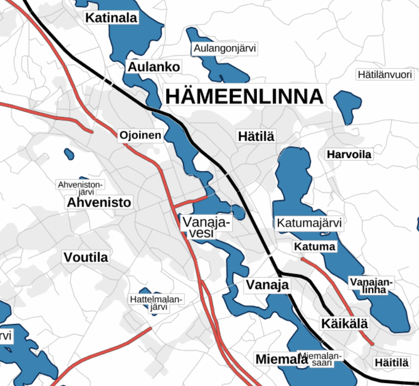
The Plain map series is a simple, plain and readable dataset product series in raster format that depicts the whole of Finland. The product is meant to be used as a background map whose character changes to a guide map in large scales. Impaired vision has been taken into account when designing the product. The key objects presented on the map are roads and railways, road names, buildings and constructions, administrative borders, waterways and other geographical names. The road network, public buildings and texts have been especially emphasised. The most usual limitations of colour vision have been taken into account in the use of colours. The product belongs to the open data of the National Land Survey of Finland.